Tuesday, July 30, 2013

The End of the Highway

Day 48, Tuesday, July 30

We departed DSCN2756for Fairbanks this morning, and on the way stopped at Delta Junction, the end of the Alaska Highway.  This is the milepost marker for mile 1,422, the end of the Highway.  If you remember, we also got our picture taken at mile 0—that means we have travelled the Alaska Highway from start to finish, with the Top of the World in between!  We even got a signed certificate that certifies that “Jim and Connie Lund have braved potholes, rocks, gravel, grit and mud, successfully driving the Alaska Highway from Mile 0 at DawDSCN2757son Creek, BC to Mile 1422 at Delta Junction, Alaska!”  Very cool! 
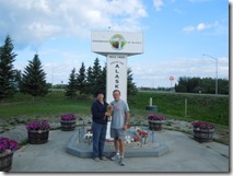
Also at the milepost marker were larger than life mosquitos--we’ve seen plenty of those too!  The Alaska Highway merges into the Richardson Highway, which we followed to reach Fairbanks.

We took off early this morning, and on the way saw a mama moose and her young calf. The mother was taking good care of the baby, jDSCN2750ust grazing alongside the road.  

It made me think of my own kids who sent me a picture from the Brickyard on Sunday.  Check out the Tom&JenBrickyard hat from 1994 with Jeff Gordon’s signature on it!    Almost as good as being there!  Love to you kids from your mama moose!


Also on the way to Fairbanks, we saw a spectacular DSCN2763view of the Alaska pipeline, suspended 1200 feet across the Tanana River between two towers.  The Alaska pipeline is 800 miles in length, and this is the second longest of the 13 major bridges along the pipeline.  To give you a perspective on size, the pipe is 48” in diameter!  WOW!


We reached Fairbanks, and feel like we are in civilization again!   There are 4 bars on our phone (hooray!).  And internet works (yippeee!!)  There are traffic lights, and more than one street, and a mall and a Walmart and a Sam’s Club!   It’s been quite awhile since we’ve been in a city this size.  But, it’s all relative…the population of Fairbanks is only about 30,000. Here are some tidbits about Alaska to ponder….Alaska is the biggest state in the Union—2.3 times larger than Texas!  (There was a great t-shirt in one of the shops that said “Size Matters”, and had a state diagram of Alaska with Texas shown in the middle—we got a chuckle out of that!)    But the entire population of Alaska is only 700,000—that’s less than the population of the city of Indianapolis!  There is a huge amount of land, and very few people occupying the land…It is truly a land of wilderness.

We are getting ready to leave for a salmon bake tonight, and a show at the Palace Theatre.  Tomorrow we will have time to explore more of the city…can’t wait!

I wanted to share a picture of the rainbow that appeared last night about 9:45 pm over the campground after a short rain shower. The pictures don’t really do it justice… This was the most brilliant and largest rainbow I have ever seen!  It was a full arch, and so big, we couldn’t even get the full arc in the picture.  At one side was a double rainbow.  It was simply beautiful.  I already had my pj’s on, but Jim called me outside to see it, and I’m glad he did.  (This also gives an idea on how light it is at 9:45 in the evening—notice the clouds above the trees in the second picture..it’s still complete daylight!)

DSCN2713DSCN2746

Took a trip to Tok

Day 47 – Monday, July 29

We continued our journey on the Taylor highway to Tok, which is on the Alaska Highway and considered the crossrDSCN2740oads of Alaska, since you have to pass through Tok both coming and going through Alaska.  It is the major overland point of entry into Alaska.   They have also said it’s the car washing capital of the world since everyone that has been over the Top of the World highway has to wash their cars and rv’s once they arrive!  The drive today was 78 miles, but took more than 2 hours.  We learned about frost heaves which cause the road to be wavy and and creates “whee bumps” as you drive over them.  It’s hard to see them in the road, but it’s not hard at all to FEEL them!

The road was a lot better today than yesterday, but there were still a lot of gravel areas and bumpy spots.  When we arrived at the rv park, there was an rv-washing party…the campground granted use of their wash area for the occasion.

We FINALLY have phone service—hooray!!!  And we have an hour of wi-fi, so I can get the blog posted.  I tried last night, but it timed out twice, and then my time ran out.   Hopefully at our next stop we will be back to being connected again…at least for awhile.

It was chilly when we got up today, but quickly warmed up to the 80’s.  TheDSCN2741re were a few raindrops later in the day when we had a birthday party for our wagon master who hit the big one (60) today! 

We head to Fairbanks tomorrow…another long driving day…only 202 miles, but expected to take about 7-8 hours.  Roads will continue to be bumpy, but that only adds to the adventure!!

On Top of the World!

Day 46 – Sunday, July 28

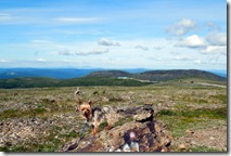
We’re on the Top of the World Highway today! DSCN2707-001 What an unbelievable experience to drive this road.  The 108 mile drive took us 5 hours!  In some places, we were going 10-15 miles an hour to keep from bumping off the road. Spot had his picture taken at the highest point on the road—so he was on top of the world too!  It is right before the border, and In the background, you may be able to see the customs station.

The beginning of the trip was a ferry ride across the Yukon River.  Seeing the ferry, you’d think there’s no way an RV would fit on there….but they loaded TWO rv’s at a time, and filled in with cars!  It took 7 minutes to get across the river.  It was a very efficient process, and very exciting too for the Lundcruiser to get a boat ride!  DSCN2653DSCN2674

DSCN2666

The ferry runs 24 hours a day, 7 days a week until the river freezes—sometime in October/November.  Then, people just drive across the frozen river to get to the other side!

The ferry is mile marker zero at the beginning of the Top of the World Highway, and the road lived up to it’s billing!  The road on the Canadian side was much better than the US side, although each stretch provided a variety of excitement.

DSCN2689  DSCN2710-001DSCN2715

There were DSCN2720beautiful views all along the way….along with a lot of potholes and washboard roads which kept Jim busy the entire trip.   There were dirt roads and rock roads and everything in between!

DSCN2713


This picture shows the condition of the road we travelled on.  In frontDSCN2695 of us  are caravan friends from Michigan.


We made it across the border, and finally made it to Alaska, 12 days after beginning the journey on the Alaska Highway!  We are now 1/4 the way through our 48 day Alaska trip! And, we are now on Pacific Time…we gained an hour, so are now 4 hours different than Indianapolis time.  DSCN2709

DSCN2708

We arrived at our destination:  Chicken Alaska.  The city was originally named Ptarmigan (a bDSCN2722ird) but too many people had trouble spelling it, so they changed the name to Chicken!  I think the population here is 37 during the summer, but only 3 of those people stay around for the winter.  When caravans like ours come to town, the DSCN2725population doubles!


In anticipation of our travels here today, our wagon masters prepared dinner for us last night…chicken noodle soup and chicken salad!! (pretty clever menu, huh?) We were entertained by a few guys from the group, then had an “after dinner” party to talk about the upcoming drive across the Top of the World Highway.

DSCN2638

DSCN2640

After we arrived in Chicken, we had time to do a little gold panning, and took a tour of the old Pedro mine dredge to understand the old-time process of gold mining.

DSCN2724DSCN2729

We ended our day with a dessert party (fresh blueberry crisp and ice cream—yummy!) compliments of the campground owners who actually picked the blueberries, made the dessert and then and served us!  Blueberries are in season here now.

It was an action-packed day—I think we will all sleep well tonight!

DSCN2735

Saturday, July 27, 2013

Brickyard Blues

Day 45 – Saturday, July 27

This is the first year since the Brickyard 400 began that we have missed the race!   In a normal year, we would be camping in lot 4A at Indianapolis Motor Speedway.  Instead, we are camping in the Yukon, 4000 miles away!   We will be driving on the Top of the World Highway on Sunday, so it is doubtful that the NASCAR channel will come through on Sirius.  With the 3 hour time difference, we are hoping we can catch the start of the race.  Be assured that we will be thinking of the racers, and the fans, and sending special good wishes to Tom & the 24 team…Get ‘Er Done!

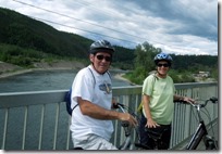
Today we took a bike rideDSCN2630 across the Klondike River to the downtown area of Dawson City.  The streets in downtown Dawson City are all dirt roads.  Because of thDSCN2626e harsh winters, it is difficult to keep them smooth.  We explored the shops and had lunch at the lounge in the El Dorado Hotel, where we were able to watch part of the Nationwide Race.

DSCN2636DSCN2631

The “scar” in the hilDSCN2635lside is called Moosehide Slide, and is the result of an ancient landslide. (not from mining).  It used to be used as a navigational landmark for river travellers.  It is a very visible landmark at the end of the streets in Dawson City.


Robert Service was a bank teller, who later became a famous writer and pDSCN2629oet in the Yukon.  There are roads, schools and streets named after him.  He memorialized the Klondike Gold Rush in books and in poetry.  His rustic log cabin was his writing retreat, and we visited it today at the top of the hill on the edge of town.


Since wDSCN2625e will be travelling on Sunday, we went to mass at St. Mary’s, a small beautiful church in downtown Dawson City.  There were 11 people at mass!, and 7 were from our group!


Tomorrow will be a big day driving over the Top of the World Highway.  For the past 3 days we have been watching and talking to people coming in to the rv park from there.  Their dirty, dusty rigs tell part of the story, but they are quick to complete the story with tales of the treacherous roads.  Apparently the rains have softened the shoulders of the road, making it difficult, especially with two vehicles coming opposite ways trying to pass each other.  One guy told us one wheel of a tow vehicle caught on the side of the road and pulled the rv off!!   What a fun(?) experience it will be!  Tomorrow’s blog will provide a full report from the other side of the Top of the World!

Diamond Tooth Gertie

Day 44- Friday, July 26

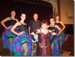
Dawson City hDSCN2611as quite a history of colorful characters.  One of them is Diamond Tooth Gertie who ran the gambling bar and saloon in Dawson City. It continues to operate. We went to a show there tonight. The show was entertaining, and the piano player was great!  We were sitting at a table in the front, and a few from the group were taken on stage.  JDSCN2586im was careful not to make eye contact during the show, but joined a group of them after the show!  We tried the slots and Blackjack after the show, but Diamond Tooth Gertie wasn’t very nice to us!   

Earlier today we were treated to a tour by Marie who told us some great stories about the characters and the area.DSCN2574 It is a very interesting place, and fun to imagine what life was like in a gold rush town.             

  After the tour we had lunch at Jack London’s Grill, and were entertained by a piano player that walked in off the street!  Jack London, the American author, spent quite a bit of time in the Klondike area.

DSCN2585

Remember Murd the barber?  Well, he told us to look for the Keno, the sterDSCN2577nwheeler that his dad worked on, and sure enough, we found it! 

We also found an interesting house with grass on the roof!

DSCN2576All of the buildings in the city are very old, and most were built in the 1900’s to support the community life during the gold rush years.  An interesting fact is that the buildings are built on “cribs”, or raised platforms, to protect the permafrost underneath.  The permafrost is permanently frozen earth.  If the permafrost melts, it causes huge shifts in the ground, which causes problems for the buildings resting on top.

Tonight we also visited the Midnight Dome.  It is a metamorphic rock, 2000 ft tall that sits at the edge of the city.  It is a great lookout point, and from the top you can see the Yukon river, the Top of the World Highway, and a great view of Dawson City.  The dome is a popular gathering point for people to watch the midnight sun.  We didn’t stay up til midnight, but did enjoy a visit to the top of the done. DSCN2614DSCN2615

On the way down, we came upon a sly fox sitting in the road. He had DSCN2619a mean looking face.  We will add him to our wildlife tally!

Thursday, July 25, 2013

Gold Rush!

Day 43 – Thursday, July 25

We’ve been on the Alaska Highway since we left Dawson Creek on July 13th, (about 1,000 miles) so it was a little stressful when we had to look for the turnoff for Highway 2 -- the Klondike Highway.  (Not really…there are only 2 or 3 roads in the Yukon, so it would be very hard to get lost…just have to make sure you’re going north and not south!) This route was chosen so that we can travel on the famous Top of the World Highway on Sunday, and then we’ll loop back to the Alaska Highway for the rest of our trip.  Today was the longest drive of the trip—7 1/2 hours to go 336 miles.

Our destination is Dawson City, a gold rush town.  It was the center of the 1898 Klondike Gold Rush.  At one time, the city had 100,000 people here…all looking for gold.  Today the population is around 2,000, and some are still mining!  We are staying at the Bonanza Gold RV Park right at the south end of the city.

DSCN2565

Our trip here included an encounter with more road construction…there were gravel rollers coming toward us on the other side of the road, and I caught this guy, wishing he was riding with us!   And…we found another very narrow bridge…DSCN2569

We stopped at Moose Creek Lodge, and tasted the yummy Orange Raisin bread. it was an interesting rustic place with lots to look at.  We were able to get a picture of Max the Mosquito!  He looks similar to the size of the mosquitos we’ve already met!  DSCN2571DSCN2570DSCN2572

Dawson City is right on the Yukon River.  The river provided a good DSCN2573transportation route for people and supplies during the gold rush years.


And, speaking of the Gold Rush, we have a friend who is also going for the gold—a medal in the National Senior Olympic Games!  The General Randy competed in the games today in Cleveland, one of 27 contestants in the high jump competition.  He has trained for months at his specialty, and ended up with a podium finish!  Congrats Randy—what an accomplishment—we’re proud of you!